|
Ice Age Floods
Study of Alternatives
Section D—Background |
|
s u m m a r y |
|
This section presents a brief overview of the Glacial Lake Missoula Floods story,
two of the key people involved with discovering the Floods and the glacial lake from which the Floods originated, and events
that led up to the initiation of the Ice Age Floods Alternatives Study. |
1. Geologic Background
In recent geological history, portions of the United States have been the site of several
massive flooding events caused by the abrupt drainage of glacial lakes. The most dramatic of these events are the Ice Age
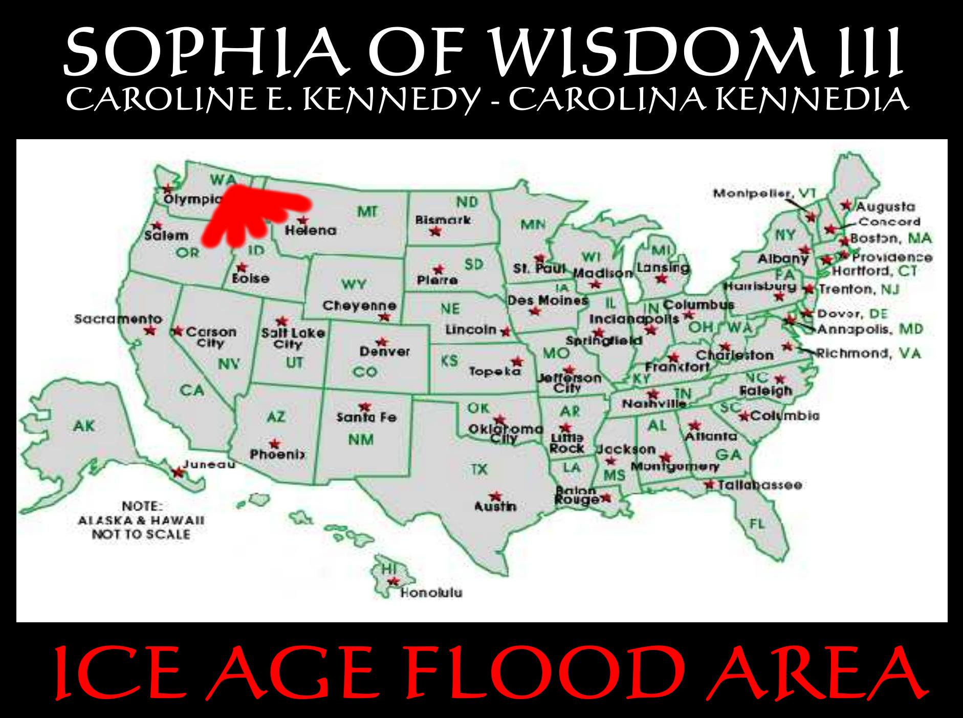
Floods that covered parts of Montana, Idaho, Washington, and Oregon. For a better understanding of the Floods, perhaps a good
place to start is to first look at the geological and climatic changes that led up to these cataclysmic floods.
| |
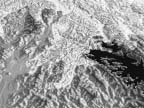
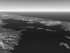
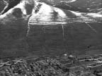
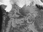
Today’s travelers to the Northwest are witnesses to a story that puzzled geologists
for years. (NPS Photo) |
Generally accepted scientific evidence indicates that the earth is around 4.5 to 4.6
billion years old. Glaciation can be traced all the way back to the Proterozoic Era, approximately 2.3 billion years ago,
when the earth was covered with ice. Near the end of the Proterozoic Era, between 850 and 600 million years ago, rock records
indicate another global glaciation period.
About 200 million years ago the Atlantic Ocean began to open up and the continents drifted
into their current configuration. The dinosaurs became extinct 65 million years ago, and about 20 million years ago, in late
Cenozoic Era, the Pacific Northwest started to look much as it does today, with its mountains, valleys, and shorelines.
Ice Ages have occurred sporadically throughout the earth’s history, although they
represent a relatively small part of geologic time. Many of the still visible effects of the great ice sheets that periodically
covered parts of North America were produced during the last Ice Age, in the Pleistocene Epoch. These ice sheets left a distinctive
geologic record in the land forms of the Northwest.
| |
Floods of molten lava poured across western Idaho, eastern Washington, and northern Oregon.
(NPS Photo) |
From 17 to 13 million years ago, lava flows emanating from a series of volcanic extrusions
spread across the Columbia River Basin, constructing a broad lava platform across northeast Oregon, eastern Washington, and
central Idaho. These extrusions were among the largest and most spectacular lava flows of their kind. The Columbia River basalts
that flooded across the Pacific Northwest consisted of more than 42,000 cubic miles of lava. In places, the basalt is more
than two miles thick. In the Columbia Basin, the lava basalts were covered with windblown glacial dust and silt, called loess,
that is up to 250 feet thick. The Cascade Mountains were formed during the later part of these basalt extrusions.
During the Pleistocene Epoch Ice Age, beginning about 2.5 million years ago, virtually
all of southwestern Canada was repeatedly glaciated by ice sheets that also covered much of Alaska, northern Washington, Idaho,
Montana, and the rest of northern United States. In North America, the most recent glacial event is the Wisconsin glaciation,
which began about 80,000 years ago and ended around 10,000 years ago. Floods events from this last glacial period are the
subject of this report.
2. Story of the Floods
At the end of the last Ice Age, a finger of the Cordilleran ice sheet crept southward
into the Idaho panhandle, forming a large ice dam that blocked the mouth of the Clark Fork River, creating a massive lake
2000 feet deep and containing more than 500 cubic miles of water. Glacial Lake Missoula stretched eastward for some 200 miles
and contained more water than Lake Erie and Lake Ontario combined. When the highest of these ice dams failed, lake water burst
through, shooting out at a rate 10 times the combined flow of all the rivers of the world.
This towering mass of water and ice literally shook the ground as it thundered toward
the Pacific Ocean, stripping away hundreds of feet of soil and cutting deep canyons—”coulees”—into
the underlying bedrock. With flood speeds approaching 65 miles per hour, the lake would have drained in as little as 48 hours.
Over time the Cordilleran ice sheet continued moving south and blocked the Clark Fork
River again and again, recreating Glacial Lake Missoula. Over approximately 2,500 years, the lake, ice dam and flooding sequence
was repeated dozens of times, leaving a lasting mark on the landscape.
Today we can see how the floods impacted the landscape. They carved out more than 50
cubic miles of earth, piled mountains of gravel 30 stories high, created giant ripple marks the height of three-story buildings,
and scattered 200-ton boulders from the Rockies to the Willamette Valley. Grand Coulee, Dry Falls, Palouse Falls—all
were created by these flood waters, as were the Missoula and Spokane ground-water resources, numerous wetlands and the fertile
Willamette Valley and Quincy Basin.
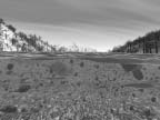
Glacial Lake Missoula contained more than 500 cubic miles of water. (Image: J. Tindall,
B. Pettus, J. Sipes) |
 |
 |
|
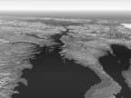
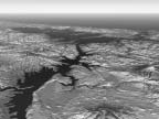
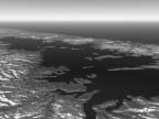
During the last Ice Age, a finger of the Cordilleran ice sheet crept southward into the
Idaho Panhandle, damming the Clark Fork River and creating Glacial Lake Missoula. At its maximum, Glacial Lake Missoula contained
more than 500 cubic miles of water and was 2,000 feet deep behind the ice dam. |
More than 16,000 square miles of land were flooded in the first-of-many Glacial Lake Missoula
floods. |
3. J Harlen Bretz—Hypothesis of Catastrophic Floods
In many ways, the story of the Floods is also the story of J Harlen Bretz (1882-1981),
who proposed the theory that the Channeled Scablands of eastern Washington, and much of the Northwest as we know it today,
were formed by catastrophic flooding.
| |

J Harlen Bretz (1882–1981)
(1949 photo by Dr. Julian Goldsmith) |
Bretz became a high-school biology teacher in Seattle. He had earlier developed a keen
interest in the glacial geology of the Puget Sound and had studied the area extensively. This interest in geology led him
to the University of Chicago, where he was awarded a Ph.D. in Geology in 1913. Then, Bretz accepted a position as an assistant
professor of geology at the University of Washington and later at the University of Chicago. His thesis was on the glacial
history of the Puget Sound, and he quickly became recognized as an expert in the features of stream and glacial erosion.
Bretz began his field research in the Channeled Scablands of central Washington during
the summer of 1922, and it quickly became clear to him that neither glaciation nor ordinary stream erosion explained the Scablands.
The following year Bretz made his two presentations to the Geological Society of America on the Scablands. The first paper
provided a detailed physiographic description of the Scablands; the second suggested that it would have taken a massive volume
of water to create the degree of channel erosion that had occurred.
Bretz’s second paper on the Scablands also discussed the mounded gravel deposits
that were scattered throughout the area. He proposed the idea of a catastrophic flood and included the first detailed geological
map that included all of the Scablands and showed the extent of the floods. Bretz used the name “Spokane Flood”
because he assumed the source of the water for this flood was somewhere near Spokane, Washington.
| |
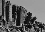
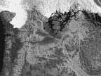
Columnar basalt at Frenchman Coulee in eastern Washington (NPS Photo) |
Bretz was confident that a flood had occurred, but was unable to figure out where the
water had come from. Originally, he proposed that the water was the result of increased runoff from melting glaciers. But
even Bretz had a tough time imagining any significant volume of water melting rapidly enough to have such devastating impact.
Not until 1930 did Bretz consider Glacial Lake Missoula as the possible source of water he was searching for. But the geologic
evidence was elusive, and he did not fully embrace the idea until 1956. Unable to provide a clear, scientific argument for
the source of flood water, Bretz went on to other activities.
Bretz lived to the age of 98 and late in life had the satisfaction of seeing his theories
validated. Perhaps it is poetic justice that in 1979, Bretz, at the age of 96, received the Penrose Medal, the Geological
Society of America’s (GSA) highest award.
J Harlen Bretz spent more than four decades defending his theories on the Spokane Floods
before they were generally accepted by the scientific community.
—John Allen and Marjorie Burns, Cataclysms of the Columbia
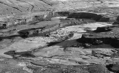
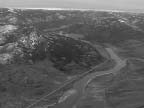
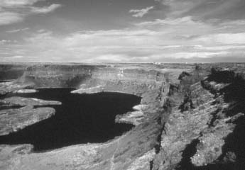
Aerial view of Dry Falls cataract, Grand Coulee, Washington, looking north. (NPS Photo) |
Bretz knew that the very idea of catastrophic flooding would threaten and anger the geological
community.
—Andrew Macrae, University of Calgary, Department of Geology & Geophysics
4. Joseph T. Pardee—Glacial Lake Missoula
Joseph Thomas Pardee (1871–1960) also played a key role in understanding the story
of the Floods. It was Pardee who proposed that the floods Bretz talked about occurred when the ice dam that had formed Glacial
Lake Missoula was breached.
In his numerous reports, Bretz rarely asked about a water source, and then only in a brief
sentence or two devoid of analysis.
Richard Waitt, USGS
“I know where Bretz’s Flood came from.”
J. T. Pardee, at a 1927 meeting of the Geologic Society in Washington DC
Pardee, a geologist with the U.S. Geological Survey, began studying the Scabland region
near Spokane, Washington, and the intermountain basins of Montana in 1910. Pardee found geomorphic evidence of a large glacial
lake in western Montana; strandlines (high water marks) indicating the maximum height of the lake are clearly visible today
in the area around the city of Missoula, Montana.
Pardee spent years collecting, analyzing, and documenting other geomorphic evidence,
and eventually the scientific community was convinced that Glacial Lake Missoula had indeed existed.
Apparently Pardee and Bretz did communicate over the years, and Pardee suggested that
Bretz consider the draining of Glacial Lake Missoula as a possible source of the Floods. But neither Pardee nor Bretz had
the scientific evidence to back up such an idea.
Later, in the late 1930s at Camas Prairie in northwestern Montana, Pardee discovered
a series of ripple marks left on the lake bottom sediments of Glacial Lake Missoula that could only have been formed by powerful
currents that flowed over the bottom, shaping the sediments into smooth, parallel ridge-rows. The marks were evidence that
the ice dam holding back the water had failed suddenly, and Glacial Lake Missoula had drained rapidly. The ripple marks are
up to 50 feet high and 500 feet apart. Because the ripples are so large, it was only when Pardee was able to view these unique
features from the air that he recognized them as being formed by water. Once they had been identified and people knew what
to look for, similar examples of giant ripple marks were found throughout the path of the floods.
| |
Giant ripple marks can still be seen clearly in Camas Prairie, Montana. (NPS Photo) |
In addition to the ripple marks, Pardee found other evidence of the ice dam failure,
including severely scoured constrictions in the lake basin and huge bars of current-transported debris.
Pardee first presented this evidence in 1940 at a meeting of the American Association
for the Advancement of Science in Seattle, Washington. His conclusions were later published in the 1942 GSA Bulletin
paper titled “Unusual Currents in Glacial Lake Missoula.” Collectively, these papers played a pivotal role in
the scientific community’s eventual acceptance of the cataclysmic flooding hypothesis. His work provided, for the first
time, a logical source of water needed to support Bretz’s hypothesis. The ripple marks were a key piece of evidence
that eventually helped convince skeptics of the cataclysmic-flood hypothesis.
Even after Pardee’s work was made public, acceptance of Bretz’s theories
was slow in coming. It took another 20 to 30 years before Bretz’s theory of catastrophic flooding became generally accepted
among geologists.
Pardee and Bretz were certainly not the only ones involved in solving the mysteries of
the Glacial Lake Missoula Floods. For example, in 1871, geologist Thomas Condon proposed the idea that Oregon’s Willamette
Valley was flooded sometime during the Ice Ages.
5. Scientific Debates—Uniformitarianism vs. Catastrophism
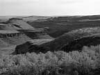
| |
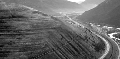
Wave-cut strandlines cut into the slope at left in photo. These cuts record former high-water
lines, or shorelines of Glacial Lake Missoula near Missoula, Montana. Gullies above the highway are the result of modern-day
erosion. (NPS Photo) |
The debate over the origin of the Channeled Scabland region of eastern Washington was
one of the great controversies in the history of geology. One reason Bretz encountered such vehement opposition to his hypothesis
of catastrophic flooding was that there were no records of such floods in modern-day experience and the magnitude of the floods
was at a scale that was difficult to imagine. The biggest difficulty, however, was that a catastrophic flood at the scale
Bretz was describing was almost biblical in proportion, and this notion was directly at odds with the idea of Uniformitarianism.
“They were all loaded for me and after letting me talk for two hours they opened
fire.”
—Bretz, after a 1927 meeting of the Geologic Society in Washington DC
It is usually interpreted as a contest of ideas between neocatastrophist Bretz and a platoon
of diehard gradualists, an image Bretz himself promoted... .
—Richard Waitt, USGS
James Hutton, a Scottish geologist, was the first to articulate the principle of Uniformitarianism,
the accepted model in geology during the early 1920s when Bretz proposed his idea of catastrophic floods. According to Hutton,
in his 1788 book Theory of the Earth, geological process is steady, slow, repetitious, and “uniform.” In
essence, Uniformitarianism says that geological processes that can be observed in the present are likely to be the same as
those that operated in the past. This model has served the geologic community well because, in general, geological changes
averaged over eons do occur slowly.
Among geologists in the 1920s, the only acceptable large-scale catastrophic events were
volcanoes and earthquakes. Beyond these events, catastrophism was considered to be “bad science” and virtually
vanished from geologic thinking. Geologists from that era attributed the creation of the Channeled Scablands to glacial erosion,
which was much more in keeping with theories of Uniformitarianism. It is perhaps understandable, then, that acceptance of
Bretz’s theories of huge, sudden catastrophic floods took as long as it did.
6. Science’s Modern-Day Evidence and Acceptance
J Harlen Bretz spent more than four decades defending his theories on the Floods before
the scientific community generally accepted them. Before this acceptance would occur, all of the pieces of the puzzle had
to come together. And it certainly didn’t hurt when scientists were finally able to study glacial floods in action.
With the eventual availability of more evidence, a plausible mechanism, and evidence for
that specific mechanism, most geologists quickly accepted Bretz’s hypothesis... .
—Andrew Macrae, University of Calgary, Department of Geology and Geophysics
Bretz’s scablands “evidence” was astonishing, and most of his descriptions
remain today as fresh and accurate as when written... .
—Richard Waitt, USGS
In the 1960s and 1970s, glacial geologists began to develop a better understanding of
how floods in glaciated lands could occur by studying jökulhlaups, outburst floods that occur from the tunneling by
water through a glacier. Although the reason the flooding occurs is very different between jökulhlaups and the Ice Age Floods,
many of the dynamics are the same. Most of these studies have occurred in Iceland, which has a unique environment, because
it has active volcanoes that create hot crustal conditions yet is a glaciated region. Basically, scientists discovered that
in Iceland subglacial lakes formed when the lower surface of a glacier starts to melt. The water is typically trapped in a
subglacial cavity until enough pressure builds up and the water escapes out from under the glacier, creating a glacial flood.
In Iceland, this type of glacial flooding occurs regularly; the cycle repeats itself every 20 years or so.
7. Increased Public Interest
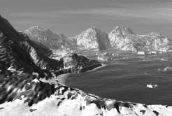
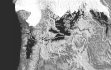
| |

Modern tools, such as satellite imagery, help scientists to comprehend the scale of the
Ice Age Floods. (NPS Photo) |
After the scientific community finally embraced the story of the Floods, research in
the Channeled Scablands and other areas impacted by the Floods increased. The result of this research was a more thorough
understanding of events that led up to the Floods and the impacts that they had on the landscape. This research, which has
resulted in dozens of scientific papers (see the Reference List in the Appendices), also has helped create a greater public awareness of the Ice Age Floods. It is only
within the past decade or so that the story of the Floods has become widely publicized via magazine and newspaper articles,
books, brochures and pamphlets, and television documentaries.
It became evident that what was needed was the development of a coordinated interpretive
and educational approach to tell the Floods story throughout Montana, Idaho, Washington, and Oregon.
Over the past decade or so, the public has shown an increasing interest in the Ice Age
Floods. In 1995, Smithsonian magazine published a feature article about the floods; several popular books have included Floods
material; several newspapers have published stories; a number of videos have been produced; and Oregon Public Broadcasting
televised a half-hour special on the subject.
The more the public learns about the Ice Age Floods story, the more fascinated they
become. After all, this is a story that seems to belong more to the realm of science fiction than to reality. The scale and
immensity of the Floods are hard to imagine; standing in central Washington it is almost impossible to comprehend that everything
visible in all directions was covered by hundreds of feet of water during the height of the Floods.
People are asking that the Floods story be told in an exciting and accessible way. It
is evident that what is needed is the development of a coordinated interpretive and educational approach to tell the Floods
story throughout the four-state area and beyond.
8. Formation of Ice Age Floods Task Force—The Early Days
While there has been more than a casual interest in the Ice Age Floods story on the
local and state levels, very little appreciation for the national significance of the Flood events has been noted, except
from within the scientific and professional geologic community. The Ice Age Floods story was publicized during the 1974 World’s
Fair in Spokane, Washington, with occasional articles featured in local and regional newspapers since that time. In addition,
a descriptive and interpretive booklet, “The Channeled Scablands of Eastern Washington: The Geologic Story of the Spokane
Flood,” was published by the U.S. Geological Survey. The booklet, which is in its third edition, is available through
the Eastern Washington University Press. To date, more than 125,000 copies have been printed.
In June of 1987, in response to a request from the National Park Service (NPS) Regional
Office to document the status of the National Natural Landmark (NNL) sites, NPS representatives from (then) Coulee Dam National
Recreation Area organized a field trip to those sites within a one-day drive of Coulee Dam, Washington.
Dan Hand, Interpretation Specialist at Coulee Dam (now Lake Roosevelt) National Recreation
Area, laid out a route of travel to include the upper and lower Grand Coulee, Withrow Moraine, Haystack Rocks, a great gravel
bar in Moses Coulee and some eskers and kames near Sims Corner. Others making the trip were Superintendent Gary Kuiper, NPS,
Craig Sprankle, Public Affairs Officer of the U.S. Bureau of Reclamation (USBOR), Judy Sprankle, Editor of the Star newspaper
in Coulee Dam, and Phil Hansen, USBOR Geologist.
From this initial field trip, it soon became evident that here was a story that needed
to be told. Other than what Washington State Parks featured within their system, there was not a single interpretive display
or roadside exhibit along the entire length of the upper Grand Coulee or at the other sites that were visited. Hansen’s
interpretation of the geologic history leading up to the series of flood events left the tour group wanting to know more.
And indeed, there was more to the story than could be covered in one day.
Judy Sprankle’s article about the Floods in the Grand Coulee Star Newspaper
had the desired effect. Local interest developed and another tour was organized for the local Chamber of Commerce and others
interested in learning about the Floods story.
About this time, Dan Brown replaced Dan Hand as the park interpreter at Coulee Dam National
Recreation Area. Brown hired an experienced photographer to develop a slide file. It would enable National Park Service interpreters
to present the story of the Ice Age Floods to the public. Ed Soldo built a slide file with more than 3,000 slides, including
aerial shots. His next season was dedicated to labeling and organizing the slides.
Brown also prepared the script for an Ice Age Floods slide program that was based in
no small part in Cataclysms on the Columbia by John Allen, Marjorie Burns and Samuel Sargent, which was published in
1985.
While local NPS representatives realized that the Floods events were of national significance,
selling the idea to cooperating agencies and eventually the public was an important first step. Officially, the NPS Regional
Director was notified by memo in August 1987 that, at least in the opinion of interested individuals, the Ice Age Floods events
met the criteria for identification as being nationally significant. NPS Regional Director Chuck Odegaard was a former Washington
State Parks Director and was familiar with the state park interpretive program at Dry Falls. He gave the go ahead to pursue
an initiative to inform agencies and the public of the value of the Floods resources.
| |
During the Ice Age Floods, Dry Falls was under 300 feet of water approaching at a speed
of 65 miles per hour. (NPS Photo) |
Realizing that elected officials would eventually play an important role, efforts were
made to work with county commissioners and Congressional delegations and inform them of the Floods resources in their back
yards. Moreover, project organizers took great pains to assure everyone that the NPS was not interested in acquiring more
land.
Project organizers contacted geologists at each of the state universities and soon were
networking with counterparts in Montana, Idaho, Washington, and Oregon.
In early 1993, the team of Dan Brown and Gary Kuiper hit the road, showing the program
to more than 70 audiences, including the Audubon Club, Grange, and Chamber groups, Tribal officials and county commissioners,
other federal officials, anyone, for that matter, who showed an interest. Each of the four states was covered, and long days
and nights were the rule. In addition, an article in the Spokesman Review written by Becky Napi generated a great deal of
interest.
Kathleen Johnson of the USGS, Spokane Office, provided the necessary maps and connected
project organizers with Richard Waitt, USGS, and others in her agency. The BLM Spokane District Office staff added to the
concept by suggesting that the Floods story be aimed at a wider regional audience. This expanded target was critical because
the BLM had a majority of the Floods landscape under its jurisdiction in eastern Washington. Soon there were solid contacts
in Montana with USFS geologists Norm Smyers and Jim Shelden, and Karen Porter of the Montana Bureau of Mines and Geology.
In Idaho, the project had the support of Roy Breckenridge of the Idaho Geological Survey. Others lending support were Dale
Stradling and Gene Kiver of Eastern Washington University and Paul Weis, retired USGS, whose publication on the Scablands
of Eastern Washington is still a popular item.
These early conversations and meetings led to a more formal approach, and on February
17, 1993, the first of seven Ice Age Floods Task Force meetings was held. Such items as an organizational structure, purpose,
action plan, strategy paper, inventory of flood features and existing interpretive waysides were identified. Most importantly,
the membership of the Task Force was meant to include the interested general public and legal entities such as county commissioners,
Tribes, Chambers of Commerce, tourism industry and political staffers. Although having all of these groups serving as active
members of the Task Force was not the point, it was essential that they be kept informed and be invited to participate in
the process.
Gary Kuiper served as the first chair of the Task Force and remained in that position
into 1993–1994. His tenure was followed by Coulee Dam NRA Superintendent Gerry Tays, who was elected by the Task Force
to serve as chair. Superintendent Tays served for the next three and a half years and continued to promote the merits of a
coordinated interagency approach.
One of the most influential events in carrying the story of the Floods to a wider audience
was the production of a video of the Floods. Initially Ann Herdrick of the Odessa (Washington) Economic Development Committee
(OEDC) approached Jim Sipes, Washington State University Professor of Landscape Architecture, about using the Floods story
to help increase tourism in the Odessa area. They started work on a video that would tell the story of the Floods and guide
people to significant Floods features, specifically around Odessa. Around the same time both Superintendent Kuiper and Interpretive
Specialist Brown realized they could not continue indefinitely to take their “road show” to every group that requested
it. The decision was made to combine forces, and the result was the production of the 13-minute video, “The Great Floods:
Cataclysms of the Ice Age.” (A video called “Floods of Fire and Water” was subsequently developed for OEDC
in June 1994.) The video combined the narrative and some photos of the slide show with video and computer animation sequences
developed by WSU that showed the Floods roaring across the landscape of northwestern Montana, Idaho, Washington, and Oregon,
and finally out to the Pacific Ocean. Three WSU students, Bruce Morrow, Mike Spencer, and Andrea Blake, assisted Professor
Sipes in the effort. The product was an instant success, having been aired on PBS, shown at visitor centers and schools, and
receiving several national awards.
While the notion of a coordinated interpretive approach remained a primary goal, the
Task Force became inactive pending the availability of study funds.
9. Formation of the Ice Age Floods Institute
Toward the end of 1993, members of the Task Force discussed the need for a private,
nonprofit organization that would complement the interagency Task Force. The consensus was that the private sector could more
readily support and participate in the development of a coordinated interpretive program. A number of individual citizens
and representatives of business groups had already been attending Task Force meetings.
| |
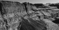
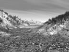
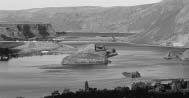
The gorge below Palouse Falls, Washington, with talus slope. (NPS Photo) |
With assistance from some members of the Task Force, the Ice Age Floods Institute was
organized early in 1994. Officers and a board were elected, bylaws and articles of incorporation were adopted, and the process
to qualify as a Washington nonprofit corporation and to be granted 501(c)(3) status with the IRS was initiated. Mikki Kison,
a Ritzville, Washington, resident, served as its first president. Dale Middleton currently serves in that role and has been
instrumental in the development of this Study of Alternatives. The first Institute newsletter was published and sent to individuals
from the Task Force’s mailing list. Institute members adopted a logo, and Task Force members helped design and produce
a brochure that is still being used. The purpose of the brochure was both to promote interest in the Floods and to recruit
members for the Institute. The Spokane Chamber of Commerce provided a home base for the Institute in this formative period.
Over the course of the year (1994), the Institute became active and visible in promoting
the concept of a comprehensive interpretive program. Presentations were made to tourism and business groups, and statements
of support were received from several Chamber of Commerce groups. One Institute member in particular, Karen Wagner of Moses
Lake, Washington, Chamber of Commerce, became a leading advocate for the Floods initiative. The Institute and its objectives
were featured in a number of newspaper articles.
| |
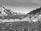
Park Lake, Sun Lakes–Dry Falls State Park, within the lower Grand Coulee. (NPS Photo) |
As a functioning group, the Task Force became less active, and then went on standby,
intentionally awaiting funding for a study. The Institute continued the effort, relying on interest and support from the private
sector. The Institute benefited from the continuing interest and participation of some agency and university personnel and
retired staff who were members of the Task Force. In addition, the BLM Spokane office provided meeting space to the Institute
for a number of years.
An important legacy of the Task Force period is the “Great Floods” video,
which became available in 1994 and has been selling steadily ever since. The video has proved to be very useful in making
presentations to a wide variety of audiences.
In 1995 an important item appeared—Michael Parfit’s excellent article, “The
Floods That Carved the West,” in Smithsonian magazine (April 1995). The article immediately became one of the
prime informational pieces about the Floods; the Institute was included in the list of “additional sources.”
One of the remarkable events in the history of the Institute was its collaboration with
NASA, Arizona State University and the Jet Propulsion Laboratory (JPL) in the fall of 1995. In preparing for the Mars Pathfinder
mission, NASA, ASU and JPL sent a team to the Channeled Scablands to examine Floods features that apparently are analogous
to features on the surface of Mars. The Institute helped with arrangements for the visit, and in the exploration of
the Scablands. The project was very well publicized.
At the time, the publication of the Smithsonian article and the visit by NASA
were encouraging, but overall the Institute was facing a rather difficult period. Substantial commercial support had not materialized,
and there was little apparent progress toward the goal of a comprehensive interpretive program. The Institute moved its base
of operations from Spokane to the Ritzville Chamber of Commerce, then to the Odessa Economic Development Committee, and finally
to the Moses Lake Chamber of Commerce, where it currently has its headquarters.
Some individuals who had been involved in the Task Force and the Institute dropped out.
A small group remained to hold the Institute together and to keep the idea of a coordinated interpretive program alive, and
they succeeded. No one could know that within about three years, a ground swell of media and public interest would emerge.
This small, yet growing group of dedicated individuals persevered for several years,
sharing their enthusiasm amongst themselves and with others. In October 1996 the Institute offered its first field trip, led
by a retired USGS geologist and Task Force member. It included sites in the Spokane and Idaho Panhandle area. It was originally
hoped that field trips would be an annual activity, but none was offered in 1997.
A new guidebook appeared in 1997: Fire, Faults & Floods: A Road & Travel
Guide Exploring the Origins of the Columbia River Basin, by Marge and Ted Mueller (University of Idaho Press). The book
covers the Columbia River Basalt flows, as well as the Ice Age Floods.
After years of effort, a dramatic turning point came in 1998. From the following events,
it is clear that interest in the Floods had reached a remarkable level:
- Grant County Commissioners (WA) voted to assist financially in the operation of Dry Falls Interpretive
Center, in order to keep the center open seven days a week in the summer season.
- The governing boards for Washington State Parks and the Idaho Department of Parks and Recreation passed
resolutions of support for the proposed NPS Study.
- KSPS (Spokane) began production of a one-hour TV show on the Floods, to be shown in the spring of
2001.
- Oregon Public Broadcasting (Portland) aired a new half-hour show on the Floods.
- Discovery Channel included a segment about the Floods in a two-hour show titled “Amazing Earth.”
A particularly significant event in 1998 was the publication of the large map, by the
Northern Region (Region 1) of the U.S. Forest Service (USFS) in Missoula, Montana, “Glacial Lake Missoula and the Channeled
Scabland.” The map, which shows the whole region affected by the Ice Age Floods, went on sale late in the year and quickly
became a best-seller. By February 2000 the map had gone through three printings and 15,000 copies had been sold. As a gauge
of public interest in the Floods, these figures are hard to ignore.
None of the projects listed above were a direct result of Institute initiatives, but
the Institute was active in encouraging and/or publicizing these projects.
In the Institute’s own program, three developments were noteworthy in 1998:
- The Institute’s website was established and continues to be hosted by the Idaho Geological Survey,
at the University of Idaho. The site has attracted new members to the Institute, some from outside the region.
- A major field trip was conducted to explore the Glacial Lake Missoula area in Montana, and it received
an enthusiastic response in print and broadcast media. The tour was organized and led by a USFS member of the Task Force.
- The Institute, largely through its newsletter, became established as an effective source of
information about Floods activities and resources.
The Institute and the Study
After years of effort to have the Floods formally recognized for their significance,
the first procedural “giant step” came early in 1999, with the announcement by the National Park Service that
funding for the Study of Alternatives had been secured through the Congressional appropriations process. The Institute has
taken an active part in the conduct of the Study and wholeheartedly supported its objectives. Participation in the Study was
the most important activity of the Institute membership in 1999 and 2000, and interest in the Study can be credited for a
substantial increase in Institute membership. The prospect of successfully launching an interpretive program has proven to
be very effective in generating even greater interest and involvement. Institute members have made presentations on the Floods
and the Study to local groups, and have been working with these groups in order to encourage their participation and input.
Over the course of this Study, Institute meetings were held in conjunction with Study
Team and Study Zone meetings. Following several of these meetings, one-day field trips provided opportunities to explore important
and distinctive Floods features in five different areas of the region. The field trips were co-sponsored by the Institute
and the National Park Service. Though primarily intended for members of the Study Team and the Institute, the tours also were
open to schoolteachers and the general public. Staff at local museums and Chambers of Commerce helped with arrangements, and
the trips were well reported in the local media. Each of the field trips was subscribed to full or near capacity, and all
were well received. Credit for their success goes to the tour guides’ expertise, preparation, planning, and presentation
skills. The guides were highly qualified volunteers from the USGS, BLM, USFS, Pacific Northwest National Laboratory, Foundation
for Glacial and Environmental Research, Idaho Geological Survey, and the Idaho Department of Parks and Recreation. Six of
the guides were members of the original Ice Age Floods Task Force.
The first of the series, held in October 1999, visited dramatic sites near Moses Lake,
Washington, including lower Grand Coulee, Dry Falls, and the Drumheller Channels. In February 2000 a tour starting in Vancouver,
Washington, explored the pervasive evidence of the volume, force, and load-carrying capacity of the Floods in the Portland-Vancouver
basin. In May, a trip from Missoula, Montana, focused on the filling and sudden drainage of Glacial Lake Missoula, and included
stops in Missoula, the Clark Fork River Valley, Camas Prairie, and Mission Valley. In September a trip from Richland, Washington,
included stops at Wallula Gap, Palouse Falls, and at significant rhythmite beds in the Walla Walla Valley. Also in September
a tour was conducted from Sandpoint, Idaho, to the location of the ice dam and to features located in the immediate path of
the catastrophic outbursts that occurred when the dam repeatedly failed. Tour stops included Cabinet Gorge, Lake Pend Oreille,
and Spirit Lake.
The field trips proved to be very effective in presenting physical evidence of the Floods
and in responding to the interest and questions that the Floods story evokes. The Institute and other groups will be expanding
opportunities for expert-guided tours to explore the Floods regions.
At the October 1999 meeting, the Institute voted to form an expert Scientific Advisory
Panel because of concern about the reliability of Floods information being presented to the public. The Panel reviews technical
information developed for Institute projects and materials as well as drafts submitted by reporters and other writers who
turn to the Institute for advice. The Panel also prepared a basic fact sheet about the Floods, which serves as a guide for
writers and interpreters, and also as a source of general information.
The Institute was also active during 1999 and 2000 in a number of collaborative activities:
- Working with the American Automobile Association (AAA) to include more information about the Floods
in forthcoming AAA regional TourBooks.
- Providing referrals to help the Port of Walla Walla (WA) develop an interpretive installation at Wallula
Gap, a major site in the Floods story as well as in the cultural and overall natural history of the region.
- Assisting consultants working with Avista Corporation and local Chambers of Commerce in their development
of interpretive facilities and a scenic byway in the Cabinet Gorge Dam area and along the lower Clark Fork River.
- Working with charter flight companies to promote aerial sightseeing services over the landscape created
by the Floods.
- Beginning discussions with CarTours, an organization that produces cassette and CD touring guides
and is affiliated with the Northwest Interpretive Association.
These connections are indications of the interest of the general community in the Floods
story and of the ways the Institute can bring people together and make efficient use of resources and talents.
10. Partnerships
From the beginning, interest in the Ice Age Floods in the late 1980s, partnerships have
been an important ingredient. The creation of the Ice Age Floods Task Force brought federal and state agencies together with
tribal governments, academia, and private enterprise to examine the potential for creating a structure to interpret the Ice
Age Floods story.
Throughout this Study, the need for forming partnerships becomes evident. These future
partnerships will have to be formalized by written agreements defining the roles and responsibilities of each partner. These
partnerships will have to cover a broad spectrum and not be limited to land management agencies. Examples of the broad extent
of partnerships include:
- Chambers of commerce
- Tourism councils and commissions
- County governments
- State agencies
- Tribal governments
- Conservation and environmental groups
- Historical societies
- Geological societies
- City governments
- Visitor and convention bureaus
- Tour companies (automobile, aviation, and marine)
- Federal agencies
- Colleges and universities
- Museums
- Publishing companies
- Economic development councils
- School districts
- Energy corporations
- Private landowners whose land contains Floods resources
A start in developing partnerships has already begun. There were nine federal agencies,
six tribal governments, 17 state agencies, and seven colleges and universities involved in some degree during the early planning.
Numerous chambers of commerce and visitor and convention bureaus are active in support of the concept. The private sector
has been closely involved: it includes representatives from the hospitality and tourism industry to large power companies
such as Avista.
Additional informal partnerships have been developed over the past year. The Seattle
(WA) Public School District is working with the study consultant to develop an inquiry-based earth sciences program using
the Ice Age Floods story. Various computer and video techniques will be used to develop a teacher’s guide and resource
section to accompany the student version. Oregon Public Broadcasting (OPB) from Portland, Oregon—the producers of the
28-minute video Ice Age Flood: Catastrophic Transformation of the West—and study consultant project manager Jim
Sipes are working with the Seattle Public School District to produce an educational poster using the Ice Age Floods story
to stimulate the students to learn more about earth science by using the Floods story.
The study consultant, Jones & Jones, has also assisted the Northern Rockies Heritage
Center in Missoula, Montana, by producing computer graphics. On a Study Group level, Bruce Bjornstad, Study Zone Chair for
the Mid-Columbia Zone, has been working closely with the Columbia River Exhibition of History Science and Technology in Richland,
Washington.
As more information becomes available to the public, the public responds by offering
to help, and the network of potential partners and partnerships will rapidly grow.
11. Commencement of the Ice Age Floods Alternatives Study
In an effort to develop a coordinated interpretive and educational approach to telling
the Floods story across four states, the National Park Service funded the Ice Age Floods Study of Alternatives and Environmental
Assessment through their Special Resource Study Program. There was consensus within the region among public agencies and private
sector partners within the region that such a study was needed. Analyzing Flood features through an inventory system, the
study addresses the suitability and feasibility of federal designation and assistance, as well as various options for forming
partnerships and developing cooperative strategies. The Study of Alternatives will culminate in a final report, to be presented
to the Secretary of the Interior for transmittal to Congress.
The work of coordinating the study and completing its reports was contracted to consultant
Jones & Jones, a Seattle firm noted for its planning and design expertise. To assist in the project a Study Team was formed.
The Study Team consists of members of the original Ice Age Floods Task Force, members of the Ice Age Floods Institute, the
project consultants, and the National Park Service.
The study process relied heavily on a partnership between public and private participants.
Across the Floods region many local workshops were held to answer questions and invite the participation of residents throughout
the region.
The Ice Age Floods Study Team consists of members of the original Ice Age Floods Task Force,
members of the Ice Age Floods Institute, the project consultants (Jones & Jones), and the National Park Service.